Whakataki Search
Metlink: bus, train and ferry.
Greater Wellington Regional Council’s transport network, Metlink, connects the wider Wellington region, including Wellington City, Hutt Valley, Porirua, Kāpiti Coast and the Wairarapa.
There are more than 38 million journeys a year on the Metlink bus, rail and harbour ferry transport network. We have 5 rail lines, nearly 100 public bus routes, more than 180 school bus services and a harbour ferry service.
We work with our transport operators to deliver a connected, integrated network with patronage across all modes growing at a rapid rate. Every day we have thousands of people travelling with Metlink (across rail, bus, ferry and total mobility services) and every one of those journeys matters to us.
Plan your journey around Wellington city on buses, trains and ferries with Metlink.

About the transport network
The Metlink network comprises of:
- Over 250 public and school bus routes which service over 3,000 stops throughout the region
- 5 train lines servicing 48 stations
- 1 harbour ferry servicing 5 docks
- Total mobility service
We manage the Metlink public transport network. Our work includes:
- Managing and maintaining many of the local railway stations, bus stops, signage and Park & Ride facilities.
- Designing routes and manage the delivery of services with our operators on over 250 public and school routes and 5 train lines.
- Managing contracts with our operators to deliver our network
- Metlink communications including contact centre, website, and social media (Twitter and Facebook).
Find out more about Metlink.
Planning a transport network that works now and in the future
Metlink is the Greater Wellington Regional Council (Greater Wellington) public transport authority which plans and delivers public transport within the wider Wellington region.
Greater Wellington works in partnership with Waka Kotahi NZ Transport Agency, KiwiRail and territorial authorities to plan and fund the region’s public transport network. Greater Wellington also works with other regional councils like Horizons on inter-regional transport initiatives. Metlink is focused on providing a great service to our communities across the region and on the welfare and wellbeing of our customers and staff, particularly our frontline staff and drivers.
Metlink is building a world class, low-emission public transport network that is more accessible for people. This involves making extensive and continuous improvements to the Metlink network to deliver faster, affordable, more frequent, and reliable services which links to their three strategic priorities:
1. To continue to improve customer experience on public transport across the network
The customer experience on the Metlink network is being continuously improved based on our customers’ feedback. We have a dedicated focus on understanding customer needs and developing solutions to meet these. This includes refinements to our timetables and routes based on our ongoing reviews of performance, upgrading the usability of our online journey planning and real-time information, introducing digital payment to rail services and ensuring passengers have right information and tracing so they can continue to travel confidently during Covid-19.
2. To reduce public transport carbon emissions decarbonising the public transport fleet
Planning for a fully decarbonised bus fleet by 2030 is already underway with Metlink adding the first of 98 electric vehicles to its fleet in August, this is working towards a target of 108 buses by 2023. When all 108 EVs are on the road, they will make up 22 per cent of Metlink’s bus fleet, shaving 17 per cent off of our total carbon emissions.
3. To contribute to the regional target of a 40% increase in mode share from public transport and active modes
With public transport and active travel accounting for half of all trips into central Wellington, the highest figure in the country, there is already strong appetite for mode shift among the region’s commuters. Metlink is keen to build on this success and recognise that a strong public transport network will help bolster this figure. With initiatives such as Bike and Ride Facilities, investing in infrastructure that makes it easier to access public transport and working with operators to provide a reliable network, Metlink is well on the way to achieving this.
Find out about the:
- Latest on Metlink network changes .
- Public transport operating model (PTOM) and bus contracts
- Wellington Regional Public Transport Plan
- Wellington Public Transport Spine Study
Extra passenger services
- Park your car and ride a train. There are free Park and Ride areas at railway stations
- Take your bike on public transport or leave it at the station in our Bike and Ride facilities
- Passengers with accessibility needs are eligible for Total Mobility discounts
Get in touch
RUC FOR ELECTRIC VEHICLES: People with an EV or plug-in hybrid will start paying RUC from 1 April
SCAM ALERTS: Report a phishing scam or learn about the latest phishing scams
Online services
- Renew vehicle licence (rego)
- Book, change or cancel a driving test
- Bought a vehicle
- Sold a vehicle
- Change your address
- Buy road user charges (RUC)
- Order replacement labels
- Report a phishing scam
- Access all online services

Wellington Transport Alliance
- Project overview
- Frequently asked questions
- Wellington roadworks
- SH2 Hutt resurfacing
- SH2 Remutaka Hill road night closures
- SH53 Tauwharenīkau Bridge

Project introduction
The Wellington Transport Alliance (WTA) maintains and operates the state highway network and assets in the Greater Wellington region. WTA connect the Wellington region so you can get where you’re going safely and reliably.
Estimated project dates
Estimated project cost, project type, want to know more about upcoming roadworks.
Sign up to our mailing lists so you can find out about state highway roadworks happening in your area or on your regular journeys.
SH1 Wellington, Porirua, Kapiti (external link)
SH59 Porirua – Kapiti (external link)
SH58 Porirua – Hutt Valley (external link)
SH2 Hutt Valley (external link)
SH2 and SH53 Wairarapa (external link)
Upcoming Wellington roadworks
Information about major state highway roadworks planned for the Greater Wellington region – Wellington, Porirua, Kāpiti, Hutt Valley and Wairarapa is provided on the Journey Planner website.
Upcoming Wellington roadworks (external link)
Wellington Transport Alliance maintenance boundaries

View larger map [PDF, 98 KB]
Project Contacts
Wellington transport alliance – [email protected].
- Phone: 0800 4 HIGHWAYS
Getting around Wellington
Here’s how you can get around once you’re in Wellington. With a compact city centre and accessible transport options, navigating the capital is a breeze.
Celeste Fontein
Public transport
Buses and trains.
Wellington has an extensive public transport system that is well-used by locals. Buses and trains can get you around the city, suburbs, and wider region.
There is also the East by West Ferry that takes you across Wellington Harbour, from Queen’s Wharf in the city across to Eastbourne in Lower Hutt.
Metlink has an easy-to-use journey planner, getting you from A to B using all of the city’s transport options.
Airport Express (AX)
If you’ve arrived by plane, one of the easiest ways to access the city is via the airport bus. The Airport Express (AX) runs every 10 to 20 minutes, seven days a week. The trip takes approximately 30 minutes, and airport buses have wifi, USB charging, and luggage racks.
Pay for your journey with a Snapper card
Paying for your journey is easier and more convenient with a Snapper card. They can be purchased from the Wellington isite Visitor Information Centre or various convenience stores. Top up and tap your card on and off each mode of transport.
Wellington Cable Car
As well as being a tourist attraction, the Cable Car is mainly used as a mode of transport. The red cars take passengers from the hills of leafy Kelburn to the heart of bustling Lambton Quay. A number of attractions are located at or near the top of the Cable Car (including the Wellington Botanic Garden, Space Place, Zealandia, and Cable Car Museum). It’s a great way to bundle a number of activities together.
One of the best ways to explore Wellington is by foot. The central city is only two kilometres across, meaning you can walk from one side to the other in around 30 minutes (not accounting for any coffee stops along the way). Grab a downtown map from the Wellington isite Visitor Information Centre, and get to know the capital on your own two feet.
Wellington has an abundance of cycle lanes, so pedalling around the city is another great transport option. There are many bike hire businesses. Switched On Bikes operates from Queens Wharf and has both regular and e-bikes for hire. Fergs Kayaks also offers bikes on the waterfront. For an on-the-go option, Beam and Flamingo have electric bike and scooter share services. These are easily hired via mobile apps.
Unable to render element
Taxis and rideshare
Taxis are plentiful in the city, with multiple companies operating. They can be booked in advance or found in taxi ranks. Ride-share services like Uber also operate around Wellington and have a designated area at the airport.
If you have a private or hire vehicle, parking is available around the city. Alongside private parking buildings, on-street parking is available and is metred with time limits.
Car shares are available on demand for daily or hourly hire. Mevo and Cityhop have designated parking spaces and easy-to-use apps for hiring vehicles.
Navigation for News Categories
Closures, delays on major highways planned for next few weeks - nzta.
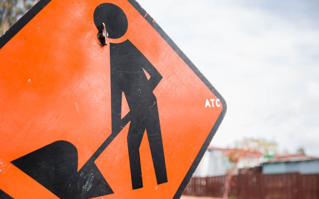
Photo: RNZ / Cole Eastham-Farrelly
The original version of this story has been clarified regarding some of the work details.
A suite of roadworks that will disrupt travel on major highways has prompted warnings for motorists to plan ahead.
Planned maintenance in both the North Island and South Island in the next few weeks means several state highways will be closed for periods as roading crews go to work.
Drivers were recommended to use the NZTA Journey Planner to check what roadworks were underway on their routes, and to find out if detours are available.
From today, 3 March until 29 March resurfacing works are planned for State Highway 2 between Masterton and Carterton, so the road will be closed between 7pm and 6am, Sundays to Thursdays.
There will also be a series of night closures on the Remutaka Hill Road between Upper Hutt and Wairarapa (State Highway 2) from 10 March, with the project planned to continue until June.
"This is a busy stretch of highway with over 7000 vehicles, on average, travelling over the hill each day," NZTA regional manager Mark Owen said.
Road closures on the hill could cause "significant disruption" the agency warned, with an approximate 3 hour detour via the Saddle Road or Pahiatua Track much further north in Manawatū the only other road option.
North of Tauranga on State Highway 2, there were eight sites where road sealing was being carried out, with more sites also to be started near Pongakawa.
But work that was being done during overnight closures on the Desert Road (State Highway 1) had been completed ahead of schedule.
Waka Kotahi Bay of Plenty Journey Manager Frankie Evans said that was good news for travellers: "We're really pleased ... this shows how beneficial it is when contractors can work in an environment without traffic."
There had been a lot of work underway during the summer, with about 250km of roads in his area resealed, Evans said.
"This may be frustrating for some drivers, however making the most of the warm and dry weather means our roads will be stronger and more resilient for longer."
South Island
Drivers travelling between Picton and Christchurch on State Highway 1 were advised to allow extra time because of several roadworks sites on State Highway 1 - a particularly useful warning for anyone driving to the Cook Strait ferries.
The work could mean 30 minute delays on the main highway near Lake Grassmere on 5 March and 7 March, as well as work on 4 March near Tuamarina.
And fibre installation would be underway on the highway between Cheviot and Spotswood, with works on that section of highway until 20 April.
In Nelson, works are being carried out on Whakatu Drive, a major route through the city, on State Highway 6, with intermittent lane closures until 16 April as well as night closures from 17 March to 27 March. People travelling to and from the airport should plan ahead in case of delays.
Speaking about road closures on Whakatu Drive that were completed in February, NZTA systems manager for the top of the South Island, Rob Service said the highway was a main route between Nelson and Tasman, so travellers should adjust their times for works on the road. Full closures can be safer for contractors "and allows them to finish the work much faster."
On the Lewis Pass, which connects the West Coast to Nelson and Canterbury (State Highway 7), there will be 30-minute delays from 5 to 8 March at some times, as loose rocks are removed.
The same work will be carried out on the Arthur's Pass, which links Greymouth-Kumara to Christchurch (State Highway SH73), with 30 minute delays expected for some times from 18 to 25 March.
- Marlborough
- Nelson Region
- Wellington Region
Copyright © 2024 , Radio New Zealand
Related Stories
'all set up ready to go' for construction of pakuranga flyover.

Auckland Transport officials have assured East Aucklanders that progress on the Eastern Busway will bring relief to their traffic frustration. Audio
Mt Messenger bypass roadblock: Court cases costing millions
Legal challenges to the Mt Messenger bypass project in Taranaki have added $37 million to its cost in 2023-24 alone.
Wellington public transport fares hiked by 10%

And free travel for under 13-year-olds and half-price fares for under 25-year-olds will end on 1 May 2024.
Auckland transport projects under review amid fuel tax scrapping

A meeting is underway for the board of Auckland Transport to determine which transport projects should be prioritised without funds from the RFT.
KiwiRail schedules 'invasive' track maintenance for low traffic times
Auckland and Wellington regional councils are struggling to afford their share of the work needed on the metropolitan train tracks, according to KiwiRail's briefing to the incoming government.
- Download as Ogg
- Download as MP3
- Download as AAC
- Play Ogg in browser
- Play MP3 in browser
- Play AAC in browser
New Zealand
- Family of Baby Ru call for police update on homicide case
- Social media agency's $320k bill for National's campaign advertising
- Ministry told school to 'evacuate immediately', five months after toxic mould found
- Meteorite hunt leader describes seeing 'fireball streak through the sky'
- Lord of the Rings fans prepare for Middle-earth Halfling Marathon
- 'Forgive me': Driver in fatal Whangārei crash expresses remorse
Get the RNZ app
for ad-free news and current affairs

Top News stories
- Economist expects Reserve Bank to slash rates by full percentage point
- Why should girls play second fiddle to boys at rowing’s Maadi Regatta?
- Why your power bill is rising
New Zealand RSS
Follow RNZ News
How to drive carefully in New Zealand

The road to Paradise, Glenorchy, Queenstown
By Miles Holden

Here's some tips on how you can drive safely around Aotearoa, New Zealand
New Zealand has some of the most incredibly scenic drives and open roads in the world. Whether you've b een driving in New Zealand for a year or fifty, it's always a good idea to brush up on road safety.
Help keep New Zealanders safe on the road with these simple actions while driving around our beautiful country.
Be aware of the road conditions

Mount Hutt ski road, New Zealand
By Mount Hutt
Before leaving home, check the NZTA journey planner (opens in new window) to avoid roadworks and congestion. Summer holidays mean more traffic on the road, and more people driving in unfamiliar environments, so make sure to drive with increased caution and care.
Check the weather forecast and be aware of conditions – you may experience four seasons in one day if travelling a long distance, and weather-related hazards can occur on the road at any time.
Our diverse terrain means roads are often narrow, hilly and windy with plenty of sharp corners. Outside of the main cities, there are very few motorways. Most of our roads are single lanes without barriers in between, and gravel roads are more common in remote areas.
It’s important to allow plenty of time, go slow, and pull over in a safe place if traffic wants to pass from behind you.
Winter driving tips
Take regular breaks

Driving in New Zealand, Queenstown
By Chris Sisarich
It is critical to stay alert while you are driving. Take advantage of rest area signs where you can stop. Don't drive when you are tired and take regular breaks. It doesn't matter where in New Zealand you're going; it is extremely dangerous to drive when you are tired.
In summer, hot days and long-distance driving can make you especially tired, as well as early starts and late nights, or because you had a long day driving the day before. So make sure to stop for regular breaks when required.
Make the journey part of the holiday
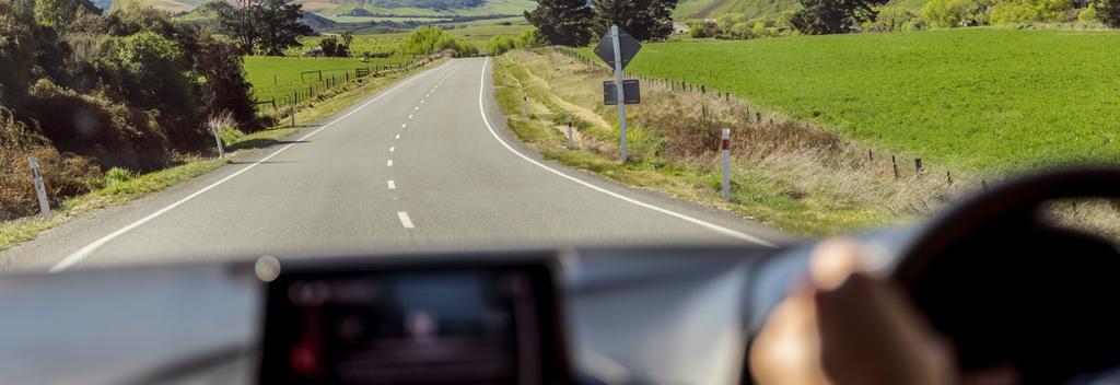
Road Trip near Punakaiki, West Coast
By Matt Crawford
It’s easy to underestimate drive times when looking at a map.
Maps don’t show how narrow and windy roads can be. What might look like a short trip can take a long time. For example, Hokitika to the town of Haast, a popular drive for visitors stopping to see New Zealand’s glaciers, is 278 kilometres on the map and may look like a short three-hour drive. However, drivers should allow for up to four hours of driving time because of the windy road. This is common all over New Zealand.
Take your time, allow for more time than you think you’ll need, and make the journey a part of your holiday.
Check out our time and distance calculator to estimate your driving time.
Keep your cool
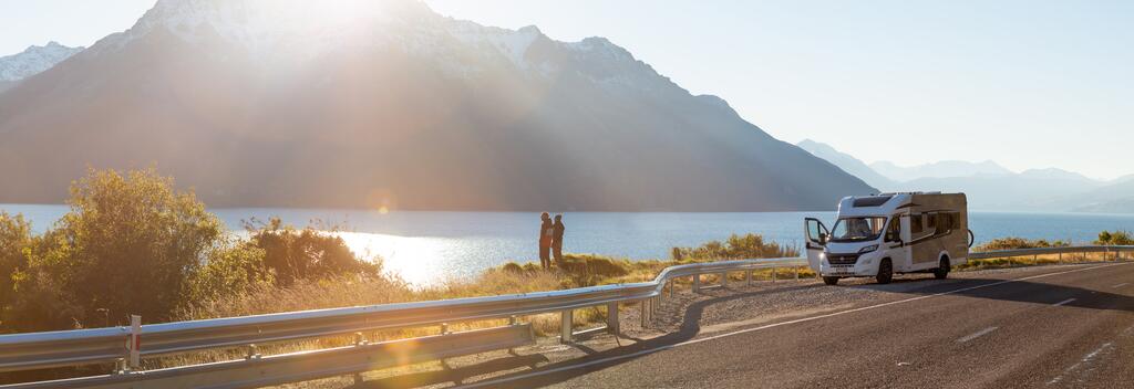
Motorhoming in New Zealand, New Zealand
By Wilderness Motorhomes
Holiday driving can be frustrating, with busy roads, stifling heat, and everyone out enjoying Doing Something New – so make sure you are being courteous and patient to others.
Trucks and towing vehicles have lower speed limits, so make sure you are passing safely in a passing lane or when you can see enough clear road ahead to overtake carefully.
Watch out for cyclists, and horses on backcountry roads.
Don’t drink and drive
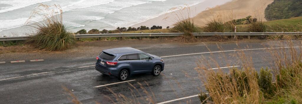
Driving in the Catlins, Dunedin
By Graeme Murray
Drink driving is dangerous and there are strict penalties for driving when under the influence. In New Zealand, the legal drink-drive limits for drivers 20 years and over are a breath alcohol limit of 250 micrograms (mcg) of alcohol per litre of breath and a blood alcohol limit of 50mg of alcohol per 100ml of blood. If you’re under 20 there is a zero alcohol limit.

Tiaki promise
The Tiaki Promise is a commitment to care for New Zealand, for now, and for future generations. By following the Tiaki Promise, you are making a commitment to act as a guardian, protecting and preserving our home.
- Share on Facebook
- Share by email
You may also be interested in...
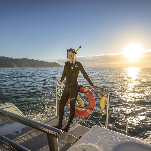
New Zealand itineraries long-arrow-right
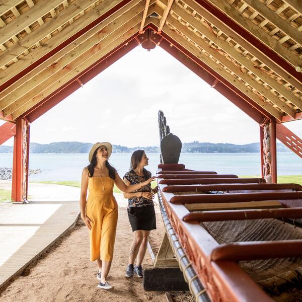
Discover short getaways in New Zealand long-arrow-right
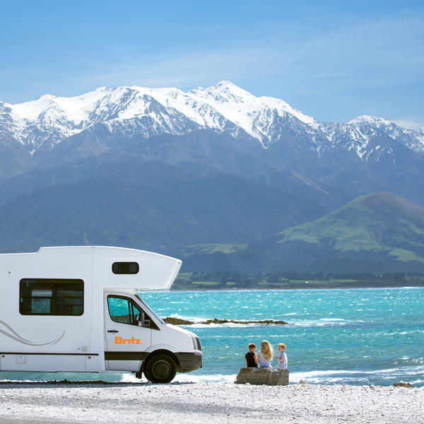
Motorhomes and campervans long-arrow-right
Closures, delays on major highways planned for next few weeks - NZTA
A suite of roadworks that will disrupt travel on major highways has prompted warnings for motorists to plan ahead.
The original version of this story has been clarified regarding some of the work details.
More from Newshub
Planned maintenance in both the North Island and South Island in the next few weeks means several state highways will be closed for periods as roading crews go to work.
Drivers were recommended to use the NZTA Journey Planner to check what roadworks were underway on their routes, and to find out if detours are available.
From today, 3 March until 29 March resurfacing works are planned for State Highway 2 between Masterton and Carterton, so the road will be closed between 7pm and 6am, Sundays to Thursdays.
There will also be a series of night closures on the Remutaka Hill Road between Upper Hutt and Wairarapa (State Highway 2) from 10 March, with the project planned to continue until June.
"This is a busy stretch of highway with over 7000 vehicles, on average, travelling over the hill each day," NZTA regional manager Mark Owen said.
Road closures on the hill could cause "significant disruption" the agency warned, with an approximate 3 hour detour via the Saddle Road or Pahiatua Track much further north in Manawatū the only other road option.
North of Tauranga on State Highway 2, there were eight sites where road sealing was being carried out, with more sites also to be started near Pongakawa.
But work that was being done during overnight closures on the Desert Road (State Highway 1) had been completed ahead of schedule.
Waka Kotahi Bay of Plenty Journey Manager Frankie Evans said that was good news for travellers: "We're really pleased ... this shows how beneficial it is when contractors can work in an environment without traffic."
There had been a lot of work underway during the summer, with about 250km of roads in his area resealed, Evans said.
"This may be frustrating for some drivers, however making the most of the warm and dry weather means our roads will be stronger and more resilient for longer."
South Island
Drivers travelling between Picton and Christchurch on State Highway 1 were advised to allow extra time because of several roadworks sites on State Highway 1 - a particularly useful warning for anyone driving to the Cook Strait ferries.
The work could mean 30 minute delays on the main highway near Lake Grassmere on 5 March and 7 March, as well as work on 4 March near Tuamarina.
And fibre installation would be underway on the highway between Cheviot and Spotswood, with works on that section of highway until 20 April.
In Nelson, works are being carried out on Whakatu Drive, a major route through the city, on State Highway 6, with intermittent lane closures until 16 April as well as night closures from 17 March to 27 March. People travelling to and from the airport should plan ahead in case of delays.
Speaking about road closures on Whakatu Drive that were completed in February, NZTA systems manager for the top of the South Island, Rob Service said the highway was a main route between Nelson and Tasman, so travellers should adjust their times for works on the road. Full closures can be safer for contractors "and allows them to finish the work much faster."
On the Lewis Pass, which connects the West Coast to Nelson and Canterbury (State Highway 7), there will be 30-minute delays from 5 to 8 March at some times, as loose rocks are removed.
The same work will be carried out on the Arthur's Pass, which links Greymouth-Kumara to Christchurch (State Highway SH73), with 30 minute delays expected for some times from 18 to 25 March.

Plan your trip with travel time information, traffic cameras, and updates on delays, roadworks and road closures.
Enter where you are travelling from and to.
This website is indicative of journey options only. There may be closures or unplanned events that could make the route shown unsuitable. Please check this section before you travel.
Find regional traffic information to help you plan your journey. See current travel times, traffic updates, information on incidents and roadworks, and traffic cameras in your region.
This section is indicative of journey options only. There may be closures or unplanned events that could make the route shown unsuitable. Please check this section before you travel.
Find road closures, incidents, roadworks and traffic cameras across New Zealand.
View traffic cameras from across New Zealand to see current road conditions, traffic jams and heavy traffic.
Use our holiday journey planner to check traffic predictions before you leave.
Every holiday period and long weekend we see large numbers of people heading out of the main centres to popular holiday destinations and this can cause queues and delays.
To help alleviate these problems we recommend planning your travel well in advance and travelling outside the busiest periods. To make this easier for you, we’ve created an interactive traffic prediction map for holiday periods. The map shows when we expect traffic to be heavy based on travel patterns from previous years.
Electric vehicle charging stations must meet certain requirements to be listed on this map. Find out more about the requirements and the nationwide network of public charging stations. Charging station details are based on information provided by the charging station operators. Read the full disclaimer .
Holiday traffic planner: NZTA's handy tool tells you when to avoid the motorways
Share this article
Traffic is expected to be heaviest heading south out of Auckland between 9.30am and 1.30pm. Photo / File
Commuting should be a breeze today if you're still stuck at work.
But if you're one of the thousands heading out of town today, the NZ Transport Agency has produced a handy holiday planner to tell you when to avoid the motorways for maximum happiness.
Based on previous years' holiday traffic, the NZTA is predicting Aucklanders heading north should avoid State Highway 1 from 11am till 3pm.
The stretch between Puhoi and Wellsford will start getting heavy at 10am and won't ease till 4pm, according to the Holiday Planner .
Heading north out of Whangārei, traffic is also expected to be heavy between 11am and 4pm.
For Aucklanders heading south, traffic is expected to flow fairly well, even in the traditional pinchpoint between Takanini and Papakura. However it will be slower going between 9.30am and 1.30pm - though it's hoped the three-laning of the Southern Motorway to Papakura will improve travel speeds.

The weather should be good for Auckland's escapees today, with cloud in the morning, a chance of a shower around midday before its fines up.
READ MORE • Hit the beach! Sunshine over most of country • Festive road works: New seal to slow Auckland Harbour Bridge traffic • Shut down: Passing lanes coned off in bid to prevent holiday crashes
Wellingtonians heading north can also expect trouble. Appalling traffic is expected between 10am and 6pm on SH1 through the Kāpiti Coast, especially between Peka Peka and Ōtaki.

Weather, crashes and other unforeseen events could impact predicted travel times. To find the most up-to-date information on your travel route, check the NZTA's Journey Planner .

NZTA's top tips for safe holiday driving
• Check your car is in good "health" before you head off: Check your tyre pressure and tread, windscreen wipers, indicators and lights.
• Take extra care when travelling in holiday periods because of increased traffic volumes, congestion, tiredness and people driving in unfamiliar environments.
• Drive to the conditions: whether it's the weather, the road you're on, the time of day or amount of traffic.
• Avoid fatigue: Take regular breaks to stay alert.
• Keep a safe following distance from vehicles in front so you can stop safely.
• Be patient: overtaking is unlikely to make a significant difference to your journey time due to the amount of traffic expected over the weekend.

Latest from New Zealand

'People focus on the headlines': Nicola Willis on recession, GDP
Finance minister spoke to Mike Hosking the day after NZ slipped into recession.

Fire crews tackle blaze on Auckland's North Shore

Power pole crash brings down lines, closes road

Far North mayor Moko Tepania will be on stage at kapa haka regionals

Kids missing school to feed families

IMAGES
VIDEO
COMMENTS
19°. 11°. Find local traffic information to help you plan your journey in Wellington. See current travel times, traffic updates, information on incidents and roadworks, and traffic cameras on your route.
To check out current road conditions, journey times and public transport options, you can access the Waka Kotahi Journey Planner below: The Waka Kotahi Journey Planner provides you with up-to-date information to make your journey as smooth and efficient as possible. Before using the network, be sure to check ahead to see what options you may ...
Plan your journey. Find travel times, incident and roadworks information, and regional traffic updates on the Journey Planner. Auckland. Wellington. Canterbury. All regions. Holiday journeys. Electric vehicle charging stations.
Plan ahead for your holiday journeys. Use our holiday journey planner to check traffic predictions before you leave. Every holiday period and long weekend we see large numbers of people heading out of the main centres to popular holiday destinations and this can cause queues and delays. To help alleviate these problems we recommend planning ...
Walking, cycling and public transport. Planning and investment. Regulatory. Māori and Waka Kotahi. Media information. Official Information Act (OIA) Our primary function is to promote an affordable, integrated, safe, responsive and sustainable land transport system. We're working to deliver our customer promise - great journeys to keep New ...
Waikato. Bay of Plenty. Hawkes Bay. Taranaki. Manawatū-Whanganui. Wellington. Canterbury. Otago. Traffic dashboards provide current travel times for key routes and journeys in a town or city.
Journey planner: journeys.nzta.govt.nz (external link) Phone: 0800 4 HIGHWAYS (0800 44 44 49) NZ Transport Agency Waka Kotahi works to create transport solutions for all New Zealanders - from helping new drivers earn their licences, to leading safety campaigns to investing in public transport, state highways and local roads.
The Wellington Network Operational Readiness (WNOR) programme is in the construction phase. Additional managed motorway technology is now being installed to help people navigate the roads more easily and keep them informed of any incidents or crashes on the road ahead. The work includes the rollout of new electronic signage to advise of ...
Select the 'Create new route' button. Enter your journey - the location you are travelling from and the location you are travelling to. Available routes will be listed next to the journey map. Select the route you want to take, and select the 'Save route' link. Customise the route details.
Greater Wellington's public transport journey planner website for buses, trains and harbour ferries.
Greater Wellington Regional Council's transport network, Metlink, connects the wider Wellington region, including Wellington City, Hutt Valley, Porirua, Kāpiti Coast and the Wairarapa. There are more than 38 million journeys a year on the Metlink bus, rail and harbour ferry transport network. We have 5 rail lines, nearly 100 public bus ...
As motorists look forward to heading out of Wellington for the Anzac Day long weekend, Waka Kotahi NZ Transport Agency is advising people to check the holiday journeys prediction tool for a safe and enjoyable journey. Holiday journeys - Anzac weekend 2021 (external link)
The Wellington Transport Alliance (WTA) maintains and operates the state highway network and assets in the Greater Wellington region. ... Kāpiti, Hutt Valley and Wairarapa is provided on the Journey Planner website. Upcoming Wellington roadworks (external link) Wellington Transport Alliance maintenance boundaries. View larger map [PDF, 98 KB ...
Journey options » Metlink. Explore different ways to travel around Wellington by public transport, including buses, trains, ferries, and bikes. Compare routes, timetables, fares, and accessibility features to find the best option for your trip.
It's important to allow plenty of time for driving in New Zealand. Use the NZTA Journey Planner for the latest road and travel time information before you set out. Check the weather forecast too, as you may experience four seasons in one day when driving long distances.
Wellington is a compact city centre with accessible transport options. Navigating the capital is a breeze. ... Metlink has an easy-to-use journey planner, getting you from A to B using all of the city's transport options. Airport Express (AX) If you've arrived by plane, one of the easiest ways to access the city is via the airport bus.
Drivers were recommended to use the NZTA Journey Planner to check what roadworks were underway on their routes, and to find out if detours are available. ... Wellington public transport fares hiked by 10%. 29 Feb 2024. And free travel for under 13-year-olds and half-price fares for under 25-year-olds will end on 1 May 2024.
By Graeme Murray. Drink driving is dangerous and there are strict penalties for driving when under the influence. In New Zealand, the legal drink-drive limits for drivers 20 years and over are a breath alcohol limit of 250 micrograms (mcg) of alcohol per litre of breath and a blood alcohol limit of 50mg of alcohol per 100ml of blood.
Drivers were recommended to use the NZTA Journey Planner to check what roadworks were underway on their routes, and to find out if detours are available. From today, 3 March until 29 March ...
Whakamahere haerenga Journey planner; Te āhua o ngā huarahi matua Highway conditions; Ngā rohe Regions; Ngā kāmera waka Traffic cameras; Ngā teihana pūhihiko EV EV charging stations; Aku Haerenga My Journeys
To find the most up-to-date information on your travel route, check the NZTA's Journey Planner. Related articles. ... Waikanae Beach death fifth fatality in Wellington region this week. 26 Dec, ...
"NZTA/Waka Kotahi and the Wellington Transport Alliance do everything possible to ensure that the planned night closures for maintenance works on Remutaka Hill are publicised as widely as possible. ... NZTA's journey planner with up-to-date information on the status of SH2, including planned Hill closures can be found at journeys.nzta.govt ...